


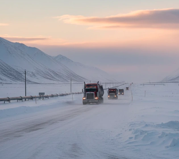
Stretching 414 miles through the bone-chilling silence of Alaska, the “Haul Road” was not built for family road trips; it was built due to an energy war. The James Dalton Highway was built in 1974, during the height of the OPEC Oil Embargo. It was the time when the United States was facing a severe energy crisis. The government realized that the United States heavily relies on foreign fuels and could not sustain its economy if there were a global energy crisis.
Discovering oil at Prudhoe Bay, the government started a road construction project that was to support the operation of the Trans-Alaska Pipeline System. The purpose was to transport the heavy equipment, materials, and supplies to the remote Prudhoe Bay oil fields. Previously, there was no roadline connected with the bay to the rest of the United States, so it was difficult for engineers to connect this remote region with the rest of the United States.
Have questions about this story?
Ask Tundra for more details, context, or updates.
Quick Facts About The James Dalton Highway
| Feature | Specification |
| Official Name | James W. Dalton Highway (Alaska Route 11) |
| Nickname | “The Haul Road” |
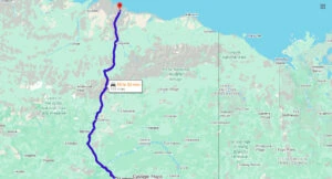
| Total Length | 414 miles (666 kilometers) |
| Start Point | Livengood, Alaska (84 miles north of Fairbanks) |
| End Point | Deadhorse / Prudhoe Bay |
| Highest Elevation | 4,739 feet (1,444 meters) at Atigun Pass |
| Surface Type | Primarily Gravel (~129 miles paved) |
| Construction Time | 5 months (April–September 1974) |
| Year Opened | 1974 (Industrial); 1981 (Public with restrictions) |
| Named For | James W. Dalton, Arctic Engineer (1913–1977) |
| Traffic Volume | 160–250 vehicles daily (seasonal variance) |
| Service Stops | Only 3 (Yukon River, Coldfoot, and Deadhorse) |
Why Alaska Needed the Impossible Road?
To understand the need for this 414-mile-long and silent road, you have to see the desperation that created it. In 1968, a 25 billion barrel oil field was discovered at Prudhoe Bay. It was not only a discovery, but a game-changing moment for the Americans, especially the Alaskans, who own this region.
But the problem was that Prudhoe Bay was not connected to any road. It was a remote region that you could not reach due to the challenging, naturally made terrain, mountains, and endless tundra. The nearest significant settlement was located at Fairbanks, which was 500 miles away to the south. For engineers, it was a real challenge to extract massive amounts of oil from one of the remote regions of Alaska.
| Year | Milestone | Significance |
| 1968 | Prudhoe Bay Oil Strike | The discovery triggered the need for the road. |
| 1969 | Hickel Highway Failure | The “winter road” that melted, proving that permafrost needs insulation. |
| 1974 | The “Arctic Sprint” | 360 miles of the road were built in just 154 days (April–Sept). |
| 1977 | Pipeline Completion | The road successfully delivers 800 miles of pipe. |
| 1981 | Naming Ceremony | Named after engineer James W. Dalton; opened to Mile 211. |
| 1994 | Full Public Access | The entire 414-mile stretch opened to the general public. |
The Push Which Accelerated Jame Dalton Highway Construction
The United States was relying on foreign countries, such as Middle Eastern nations, for fuels, including oil and gas. But due to the shortage created by the OPEC nations in 1970, the prices of fuels skyrocketed, which made things difficult for the people. Two years earlier, oil was discovered in Prudhoe Bay, Alaska, so the US government planned to shift from foreign dependency to extracting the oil within the country.
Suddenly, Alaska’s vast oil reserves became a national priority, and the government accelerated the construction of a road from Livengood to Prudhoe Bay.
Oil companies collaborated with the federal government to build the pipeline from Prudhoe Bay to the ice port of Valdez, 800 miles south. Before the James Dalton Highway, reaching the bay was nearly an impossible and expensive job.
- Air Transportation: The finest way to reach Prudhoe Bay was through air transportation, which was highly expensive and could not be used for a long duration.
- Winter Ice Roads: Another method to reach the bay was to use the seasonal routes that come into being due to the freezing winter, but still, it was not a durable way to reach the bay.
Because these major and other less significant ways to travel from one corner of Alaska to another were not reliable, that’s why the federal government brainstormed the plan to build a road of 414 miles.
The Person Behind the Name: James W. Dalton
James William Dalton is one of the most reputable engineers, who is known for a list of notable contributions. Although he did not see the James Dalton Highway in his life, as he died in 1977, it is named after him. Basically, Mr. Dalton was the one who pioneered oil and gas exploration near Prudhoe Bay.
Born in 1913, he emerged as America’s most recognized Arctic engineer. He spent most of his professional life in Alaska working on different projects in which 1968 exploration of natural resources was one of them. In 1979, the state of Alaska officially renamed Haul Road the James Dalton Highway in his honor.
Building the Impossible: Construction of the Haul Road (1974)
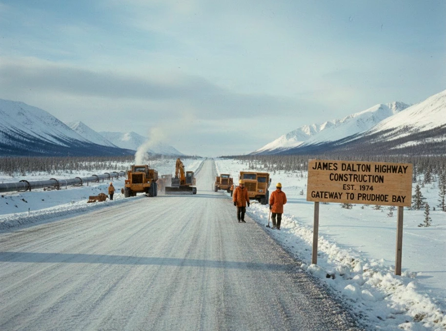
The majority of people are unfamiliar with the fact that the construction of the James Dalton Highway is known as one of the most impressive engineering feats in United States history. The basic road from the Yukon River to Prudhoe Bay was built in only 154 days, as estimated. While the additional 54-mile construction was completed shortly after that. Some of the workers who participated in the construction claimed that it was hard for them to complete the project.
The main concern of the workers was that there was no sense of time. They could not understand whether it was day or night. However, an estimation suggests that the road was constructed at a rate of almost 2.3 miles per day. The workers were there 24/7, trying to complete the project as soon as possible. The reason behind the quick completion was not the magic strategy but more than 3,400 crew members who worked unstoppably.
Challenges To Build the James Dalton Highway
- The Permafrost Paradox: It was not only hard to build a road on tundra, but impossible. When the top layer of vegetation was removed, the ice underneath melted, and the ground collapsed. Therefore, the engineers used 3 to 6 feet thick massive gravel to ensure that the ground underneath stayed permanently frozen.
- The Brooks Range & Atigun Pass: Another challenge was to carve a road traversing Atigun Pass, which is the highest point in the Alaska Highway system. The grades were steep, so it was difficult for heavy machinery to maintain traction.
- Logistical Nightmares: Those two challenges apart, but have you ever thought about how they ensured 500 mile supply chain because the nearest point was Fairbanks, where you cannot find every nut, bolt, or gallon of gas. Well, the mechanical crews worked 24/7 on the maintenance and ensured the supply chain.
FAQs
What is the history of the Dalton Highway?
The highway was built in 1974 for the trans-Alaska pipeline when OPEC created the fuel shortage. The highway was a source to reach Prudhoe Bay, where the US private companies explored a massive oil field.
What is the nickname of the Dalton Highway?
The Dalton Highway was known as Haul Highway, but in 1979, the Alaskan authorities renamed it in honor of James William Dalton.
Where is the start of the Dalton Highway?
It begins at mile 73 on the Elliott Highway and ends at the town of Deadhorse.
Who was James W. Dalton?
He is known as one of the most recognized engineers who contributed to many projects, including the exploration of oil fields in Alaska.
How long is the Dalton Highway?
The length of the highway is 414 miles (667 KM)