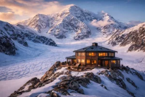


Alakanuk, Alaska, a small Yup’ik village stretched along the distributary channels of the Yukon River Delta, stands on the front line of climate change. With fewer than 800 residents and land that barely rises above sea level, the community now faces yearly floods, accelerating erosion, and thawing permafrost that threaten homes, infrastructure, and traditional ways of life.
Residents describe these changes not as distant projections but as daily realities. Many say the government response remains slow, even as storms grow stronger and land continues to disappear.
Have questions about this story?
Ask Tundra for more details, context, or updates.
Where Is Alakanuk and Why Is It So Vulnerable?
Alakanuk sits about eight miles southwest of Emmonak and fifteen miles from the Bering Sea, positioned on sediment-rich channels that shift with every major flood. Its low elevation and soft delta soils make it one of Alaska’s most flood-prone settlements. The combination of river ice breakup in spring and autumn storm surges leaves the community exposed year-round.
According to the Alaska Climate Research Center (2025), average annual temperatures in western Alaska have risen nearly 3 °F since the 1970s, destabilizing riverbanks and thawing permafrost across the lower Yukon region.
How Flooding and Storm Surges Threaten Daily Life
Each spring, melting snow and ice push water through narrow delta channels, often overtopping the boardwalks that connect homes. In autumn 2025, remnants of Typhoon Halong drove seawater far upriver, flooding dozens of homes, contaminating wells, and forcing temporary evacuations.
Residents recall how “the water reached houses that had never flooded before.” Boats became emergency transports for elders, while families took refuge in the school gym.
For those who live here, every flood season is a test of endurance. “We just have to live through it even though we don’t get any help,” said resident Alexie, reflecting widespread frustration over the lack of long-term relief and relocation funding.
How Fast Is Alakanuk Losing Land to Erosion?
Erosion has quietly reshaped Alakanuk’s shoreline for decades. Recent mapping by University of Alaska researchers recorded an average of 1.42 acres of land lost per year, roughly a football field every few months. Ice jams and high river flow carve new channels into the delta, threatening homes, fuel tanks, and roads.
In response, residents have taken extraordinary measures, dragging houses further inland with heavy machinery to escape the encroaching river. “Every year the water eats closer,” one elder said, watching a once-stable bank collapse after spring breakup.
| Erosion Indicator | 2025 Value |
| Annual Land Loss | ~1.42 acres |
| Infrastructure at Risk | > 25 structures |
| Estimated Mitigation Cost | $18 M USD |
What Role Does Thawing Permafrost Play?
Beneath Alakanuk’s surface lies discontinuous permafrost that’s increasingly unstable. The USGS Permafrost Network (2025) recorded record-high ground temperatures up to −0.2 °C at local boreholes. As frozen soil thaws, boardwalks sag, utility poles tilt, and foundations crack.
These subtle shifts translate into significant maintenance costs and constant anxiety for residents already coping with flood damage. Community leaders say thawing permafrost has become a “hidden disaster,” quietly undermining the infrastructure that sustains daily life.
Why Are Storms Becoming More Extreme?

Meteorologists note that the Bering Sea’s rising temperatures are fueling stronger autumn storms that now reach further north. Typhoon Merbok (2022) and Typhoon Halong (2025) both brought hurricane-force winds and devastating surges to western Alaska.
Scientists at the NOAA Alaska Climate Hub (2025) estimate that once-rare “50-year floods” could now occur every decade. With shorter winters and later freeze-ups, the open-water season and the threat window continue to expand for delta villages like Alakanuk.
Community Response: Adaptation and Resilience Projects
Despite worsening conditions, Alakanuk’s residents continue to adapt with resilience and determination.
1. Infrastructure Relocation:
The Bureau of Indian Affairs (BIA FY 2024–25) has funded a new Multipurpose Center and Tribal Hall to be constructed on higher, more stable ground. This project replaces aging infrastructure and symbolizes a cautious move toward relocation.
2. Community-Led Planning:
Local leaders emphasize that solutions must be designed and led by tribal members. “Communities have the capacity and the knowledge to lead,” explained one tribal representative. “What we need is tens of millions of dollars to stay or to relocate safely.”
Youth advocate Charitie Ropati echoed this sentiment, saying, “The issue is that the funding needs to get into their hands.” Her remarks capture the growing frustration among residents who feel sidelined in federal and state decision-making.
3. Monitoring Partnerships:
The University of Alaska Fairbanks and USDA Climate Hub continue to collect data on erosion and permafrost, supporting long-term planning.
While external aid helps, residents insist actual progress depends on empowering local knowledge and leadership, not just studies and reports.
Monitoring and Research in the Yukon Delta
In 2025, field teams from the University of Alaska Fairbanks mapped erosion hotspots using drones and riverbank sensors. They also measured methane emissions from thawing permafrost.
Such research is critical for planning, but locals express mixed feelings about repeated studies that rarely translate into action. As one resident told reporters, “We’ve seen people come to take pictures and data for years; what we need now is help we can actually see.”
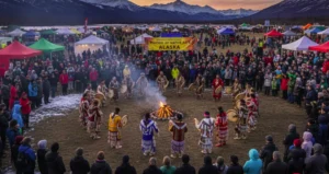
Cultural and Human Dimensions
Beyond infrastructure, climate change is tearing at the social and cultural fabric of Alakanuk. Flooding has displaced families, damaged community gathering spaces, and threatened traditional burial grounds. A 2025 tribal complaint described “loss of ancestral homelands, destruction to sacred sites, and endangerment of cultural traditions, heritage, and livelihoods.”
Many residents express grief at the prospect of abandoning land their families have lived on for centuries. “It’s like losing part of who we are,” said one community elder.
At the same time, Alakanuk’s youth continue to speak out, leading cleanup drives, documenting changes in their environment, and learning to blend science with Yup’ik knowledge to guide future adaptation.
What the Future Holds
Looking ahead, Alakanuk leaders hope for sustained funding and genuine collaboration. The Aleutians East Resilience Program (2025) has identified the village as a high-priority site for adaptation funding to elevate homes and fortify flood barriers.
Yet, many residents remain wary of promises. “We’ve been told help is coming for years,” said a council member. “It’s time we make those decisions for us.”
This growing insistence on community-led action signals a shift in how Alaska Native villages approach climate resilience: from waiting for intervention to demanding inclusion and control.
2025 Climate Impact Snapshot: Alakanuk, Alaska
| Challenge | 2025 Update |
| Flooding | Typhoon Halong surge displaced families |
| Riverbank Erosion | ~1.42 acres lost per year |
| Permafrost Thaw | Record high ground temps |
| Record Warmth | 2nd-warmest Arctic year since 1900 |
| Resilience Project | New Multipurpose Center funded |
| Community Sentiment | Residents report frustration over slow funding |
Conclusion
Alakanuk’s story is not just about climate science; it’s about people who live each day with the consequences. The riverbanks are eroding, storms are stronger, and permafrost is vanishing, yet the community’s determination remains steadfast.
From elders moving homes inland to youth advocates demanding fair funding, Alakanuk represents both the urgency of climate adaptation and the resilience of those who refuse to give up their homeland.
As one local leader summarized, “Communities like ours already know how to survive, we just need the resources to keep doing it.”
FAQs
1. Is Alakanuk, Alaska, at risk of relocation?
Yes. Alakanuk is listed among Alaska’s high-risk villages for relocation due to flooding, erosion, and permafrost thaw, according to federal resilience reports.
2. What is the main source of income in Alakanuk?
Most residents rely on commercial and subsistence fishing along the Yukon River, supported by seasonal employment and tribal or local services.
3. How can visitors reach Alakanuk, Alaska?
There are no roads. Travelers fly from Anchorage to Emmonak or Alakanuk via regional airlines or charter boats during the summer when the river ice melts.
4. What kind of houses do people live in Alakanuk?
Homes are mainly wooden structures built on pilings or raised foundations to withstand flooding and shifting permafrost in the Yukon Delta.
5. Does Alakanuk have access to the internet and cell service?
Yes. The community uses satellite and broadband networks like GCI and Starlink, though service can be slow or disrupted during storms.